Kayak The Avenue of The Giants
Breathtaking Beauty Awaits Paddlers on The Eel River
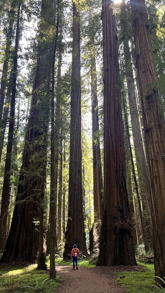
The Avenue of the Giants, a 30-mile scenic byway in Humboldt County, is famous for its towering old-growth redwoods—some over 2,000 years old and soaring more than 300 feet (91 m) high. Their massive trunks are wide enough to drive a car through (and yes, that’s actually a thing).
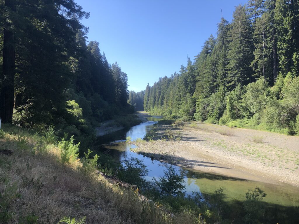
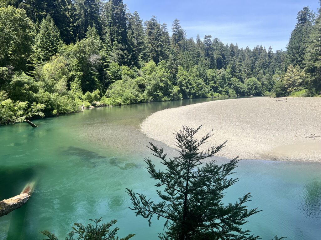
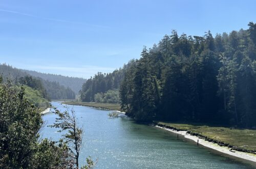
While most visitors come here to hike, camp, and admire the trees, many miss a lesser-known but equally stunning feature: the South Fork of the Eel River. This clear, cool river snakes through the forest alongside the Avenue, all the way to Founders Grove—the crown jewel of Humboldt Redwoods State Park.
For paddlers with a sense of adventure, this stretch is pure gold. With easy access points, you can plan anything from a short float to a full-day journey. This guide focuses on a segment near the state park, making it easy to combine river time with world-class hiking and camping. If you’re heading to the redwoods, carve out a few hours for the Eel—you won’t regret it.
Table of Contents: Kayak Avenue of Giants
- River Access Points
- River Description: Be Prepared, Be Safe
- The Route Details
- Nearby Attractions
- Final Thoughts: Kayaking the Avenue of the Giants
River Access Points
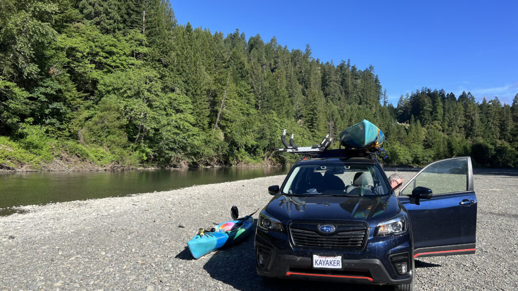
In many parts of California, driving down a riverbank might seem off-limits—but not in Humboldt County. Along the Eel River, it’s not only allowed, it’s surprisingly common. Most of the river’s edge is made up of coarse gravel that can easily support the weight of a vehicle without taking damage.
When checking maps, you’ll notice specific locations labeled “River Access Point.” These are spots where you can drive all the way down to the river. Others might be marked “Swim Access” or something similar—those usually require a short hike to reach the water.
That said, not all River Access Points are created equal. Some involve a mild, bumpy descent that’s manageable in a 2WD car. Others may require a high-clearance, 4WD vehicle to navigate safely.
The two access points described in the Recommended Route section below were no problem for our Subaru Forester and should be fine for most modern SUVs—even without 4WD. If you’re considering an alternative access point, it’s a smart move to scout it on foot before committing to the drive.
River Description: Be Prepared, Be Safe
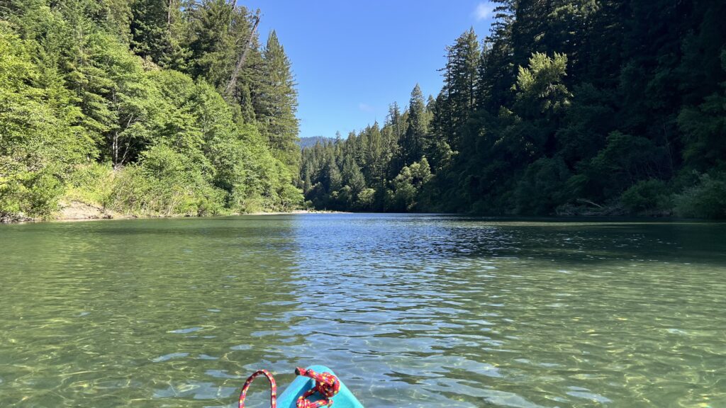
The stretch of the Eel River that parallels the Avenue of the Giants is rated Class I. It features some swift water and small rapids, but nothing too intimidating—making it a great choice even for paddlers with limited experience. Still, hazards exist, so always wear a lifejacket and make sure it’s properly secured.
What is Class I? – Fast moving water with riffles and small waves. Few obstructions, all obvious and easily missed with little training. Risk to swimmers is slight; self-rescue is easy.
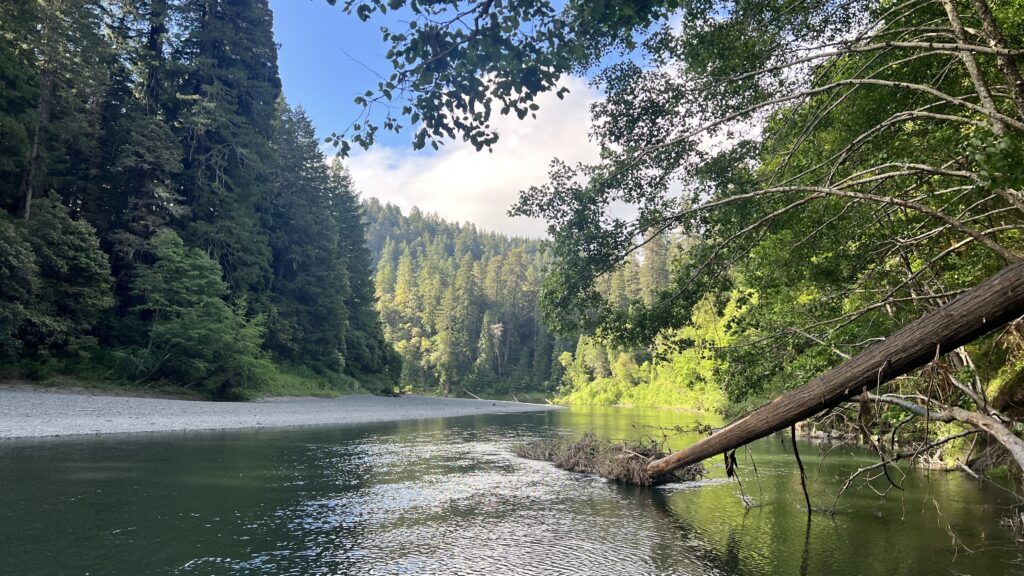
Watch For Strainers
Strainers are downed trees or overhanging brush that allow water to pass through but not boats or people. Always scan ahead and steer clear to avoid getting caught.
Shallow Spots and Flow Rates
This section has plenty of shallow stretches. You can usually avoid grounding by reading the river—look ahead and adjust your course to follow deeper channels. It takes a bit of practice, but it’s a useful skill that comes quickly.
By mid-summer, water levels can drop too low for comfortable paddling. Before heading out, check the USGS Water Dashboard for flow rates and gauge height. In my experience, if the gauge is below 6 feet and the flow is under 150 cfs, expect some long, rocky portages—and a lot less fun.
The Route Details
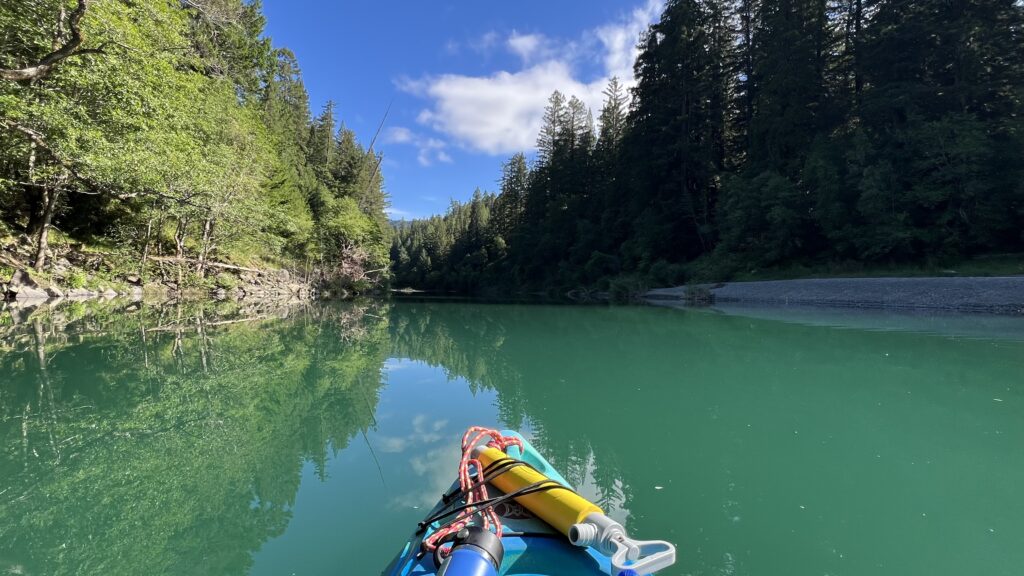
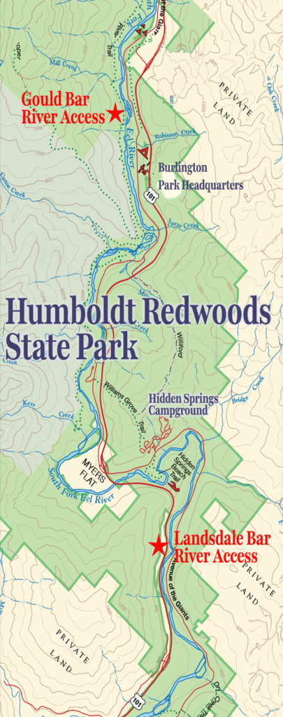
This trip begins at the Landsdale Bar River Access. The drive down to the river is a moderate descent with a few bumps, but nothing a standard SUV can’t handle. Once you reach the gravel bar, you’ll find plenty of space to park and unload. Cruise right up to the water’s edge and get your gear ready—your adventure begins here.
On the water, the river keeps things interesting. You’ll alternate between calm, deep pools perfect for floating and photo ops, wide shallow sections that require a bit of route-finding, and narrow, punchy stretches that’ll wake you up. Gravel beaches are scattered all along the route, so you’ll have plenty of places to stretch, snack, or take a swim.
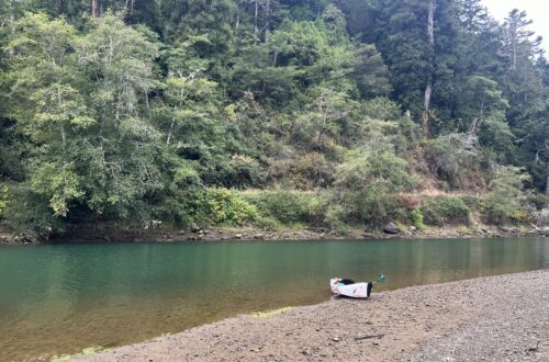
The take-out point is Gould Bar, which—heads up—doesn’t have any signage from the river. I recommend one of two things:
- Use the GPS coordinates (listed below).
- Scout it in advance like I did. I took note of the surroundings—trees, bends in the river, and landmarks—to recognize it on the return float.
Total Distance: 8.65 miles (14 km)
Launch: Landsdale Bar – 40.26841061639022, -123.84887062445692
Take-Out: Gould Bar – 40.31588732669978, -123.92272027094992
Shuttle Options
Don’t count on Lyft, Uber, or a friendly river shuttle to bail you out here—this stretch of Humboldt County is blissfully off the grid. There are no commercial outfitters offering shuttle service, and cell coverage is spotty at best.
I went the DIY route. I stashed my bicycle at the take-out and pedaled back to retrieve my car. While the float downriver took 3–4 hours by kayak, the ride back was under an hour on mostly flat roads. It’s a scenic, quiet stretch—perfect for a relaxed return.
Nearby Attractions
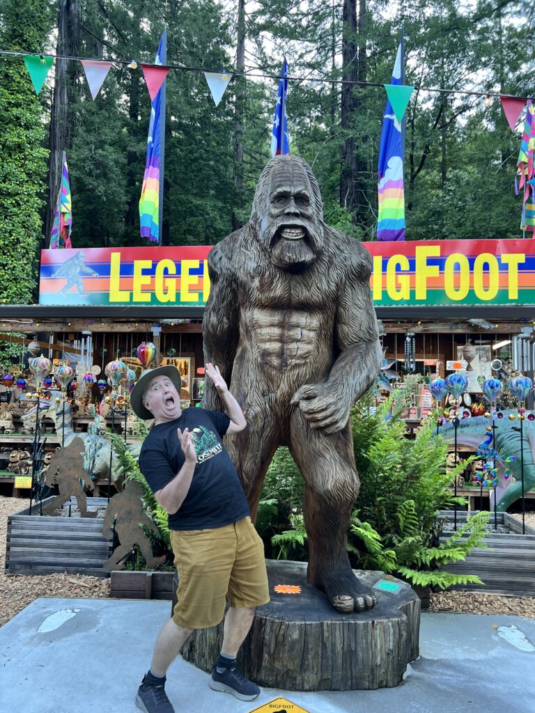
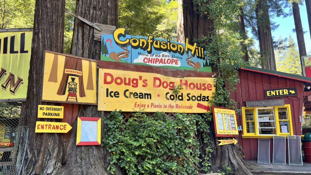
Northern California’s redwood country is wild, wonderful, and just a little weird—in the best possible way. Tourism is one of the main industries here, and the roadside attractions reflect that: quirky Bigfoot souvenir shops, gravity-defying vortexes, and the classic drive-through trees that let your car cruise through living history.
But let’s be honest—the real stars of the show are the coastal redwoods (Sequoia sempervirens). No trip is complete without standing among these giants. Take a walk through one of the many groves, breathe in the cool, earthy air, and soak up the magic of this ancient forest.
Final Thoughts: Kayaking the Avenue of the Giants
Paddling the South Fork of the Eel River is an unforgettable way to experience the magic of the Avenue of the Giants. With towering redwoods overhead and crystal-clear water beneath your kayak, this route blends natural beauty, solitude, and a touch of Humboldt County charm.
Whether you’re out for a peaceful float or a photo-filled adventure, this stretch of river delivers. Just be sure to plan ahead, scout your access points, and double-check water levels. With a little preparation, you’ll be rewarded with a one-of-a-kind journey through one of Northern California’s most awe-inspiring landscapes.
Pack a snack, bring your camera, and paddle into a place where time slows down and nature takes center stage.


You May Also Like
Mysterious Houseboats on the Albion River
Paddle Mendocino’s Big River