Paddle Tenaya Lake: Where Granite Peaks Meet Crystal Water
Paddle Tenaya Lake: Into the High Sierra’s Granite Wonderland
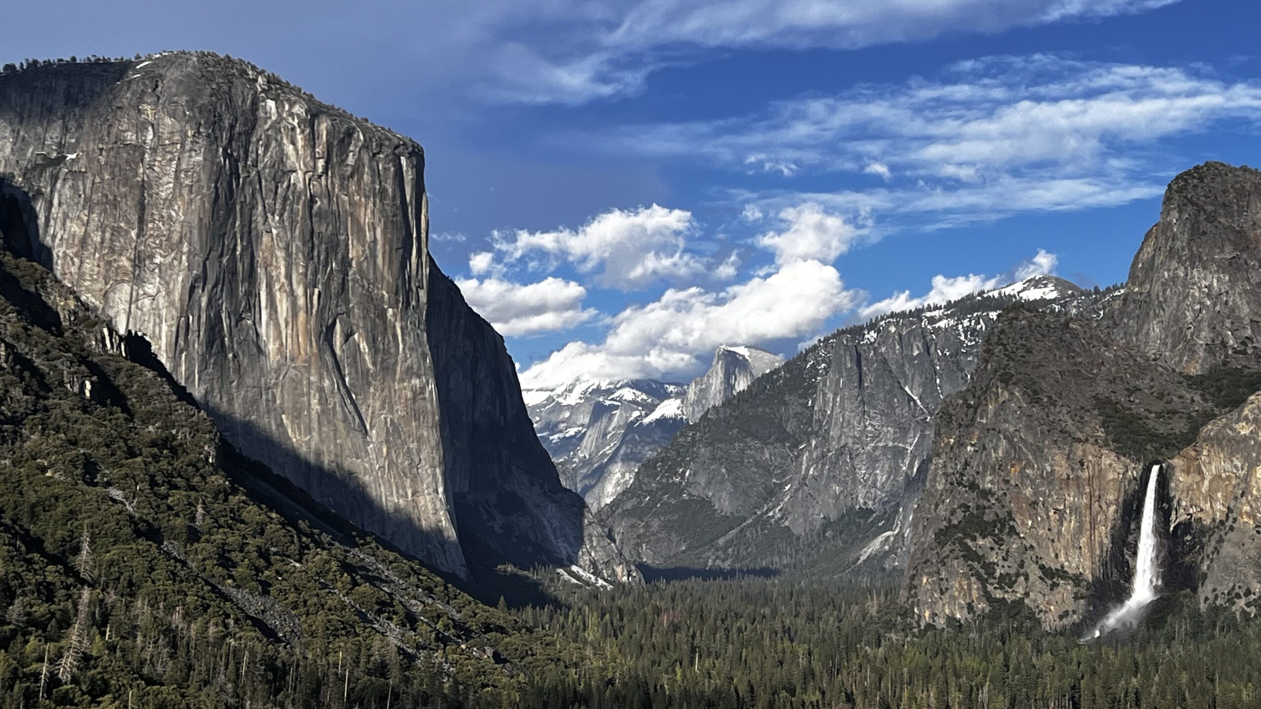
Tucked away in Yosemite’s lesser-visited high country, Tenaya Lake offers an unforgettable experience for those willing to venture beyond the valley floor. While Yosemite Valley is rightfully famous for its dramatic cliffs and waterfalls, the high country rewards visitors with quieter trails, sweeping granite landscapes, and a deeper sense of solitude. If you’re looking to escape the crowds and connect with nature, paddle Tenaya Lake, Yosemite for a peaceful, scenic adventure. Because it’s at least an hour from most campgrounds and lodging, this part of the park remains blissfully uncrowded—and all the more magical.
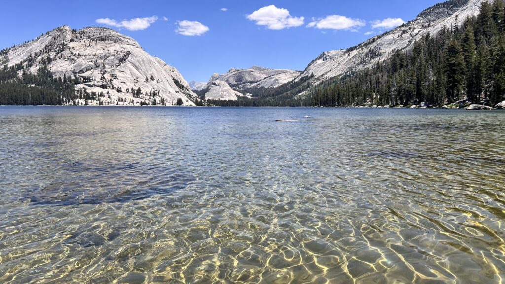
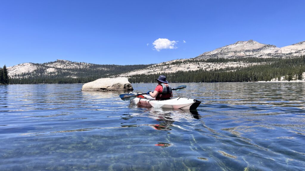
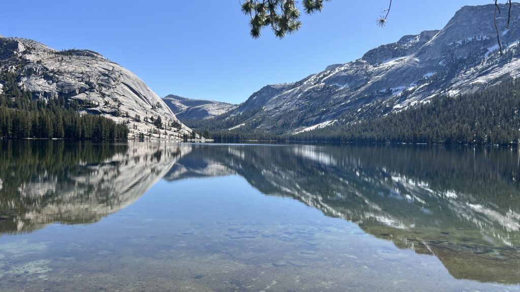
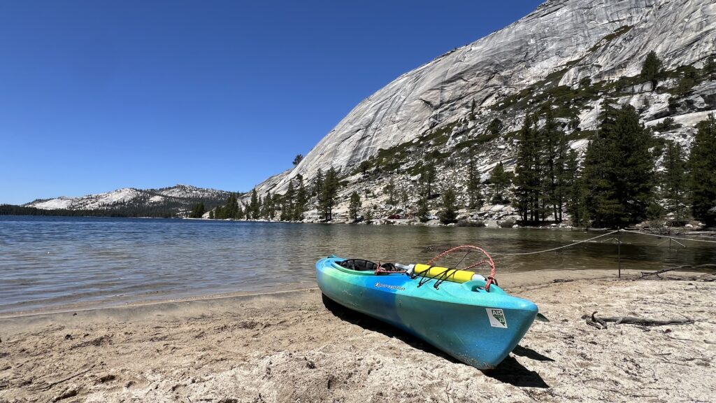
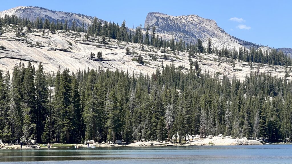
Tenaya Lake is the crown jewel of the area. Framed by smooth granite domes and rugged peaks, it looks like a scene straight out of a postcard. While many travelers stop briefly to admire the view, few take advantage of the opportunity to explore its crystal-clear waters by kayak, paddleboard, or canoe. This is one of Yosemite’s best paddling spots—and one of its best-kept secrets.
Big enough for an afternoon adventure but small enough to circumnavigate, the lake features inviting beaches and swimming areas at both the north and south ends. Bring your camera, take a dip, and soak in the serene beauty.
All it takes to paddle Tenaya Lake, Yosemite, is a bit of planning and a sense of adventure. Here’s how to make the most of your visit to Tenaya Lake.
Table of Contents – Paddle Tenaya Lake, Yosemite
- Getting To Tenaya Lake
- When to Go
- Limited Parking, Lack of Signage, Where Should You Park?
- Best Features and Facility Information
Getting to Tenaya Lake
Tenaya Lake sits high in Yosemite’s alpine country, far from many of the park’s most iconic landmarks. It’s approximately 1.5 hours from Yosemite Valley and about an hour from Crane Flat, where Tioga Road intersects with Big Oak Flat Road.
The distance may seem like a hurdle, but it’s a blessing for those seeking a quieter, less crowded experience than what you’ll find in the Valley. Be sure to allow extra time for the drive—speed limits in the park are low, typically 35 mph to 45 mph on Tioga Road. Please follow these limits; they’re in place to protect Yosemite’s wildlife, especially bears, who often cross the road unexpectedly.
The slower pace also gives you time to enjoy the journey. One worthwhile stop along the way is Olmsted Point, just before you reach Tenaya Lake. From this scenic overlook, you’ll enjoy sweeping views of Clouds Rest and a rare perspective of Half Dome from the north—something you won’t see from the Valley floor.
When to Go
If you’re planning to paddle on Tenaya Lake, arriving early is essential—for two important reasons.
First, parking is limited, and once all of the parking has been taken, there are few alternatives nearby. Second, mornings typically bring calm winds, creating glassy, mirror-like conditions on the lake. This is the best time to enjoy stunning reflections of the surrounding granite peaks and soak in the peaceful atmosphere. By afternoon, the wind usually picks up, making paddling more challenging and the water choppier.
Limited Parking, Lack of Signage, Where Should You Park?
One of the biggest challenges of kayaking at Tenaya Lake is finding convenient parking that allows you to unload your boat and hit the water with minimal hassle. Parking is limited, and signage is practically nonexistent—making it easy to drive right past the best spots.
Tip: Once you pass Olmsted Point, start slowing down. When you see the Sunrise parking area sign, reduce your speed to 20–25 mph. There won’t be any signage for the upcoming lakeside parking, so stay alert.
Tenaya Lake Picnic Area – South End
Just 500 feet (154 m) past the Sunrise sign, look for a paved loop on the right. This is the entrance to the south-end picnic area parking. It’s easy to miss—there’s no road sign and it’s slightly hidden—so keep a sharp eye out. This lot fits about 10 vehicles and offers a relatively easy 300-foot (91 m) walk to the water’s edge, making it a solid launch option if space is available.
Roadside Parking Along Tioga Road
In my opinion, the best and most convenient parking is right along the highway, immediately after the south picnic loop. Look for pullouts on the right-hand side where the lake is just steps away. Be mindful: there’s only about a quarter-mile (0.4 km) of this “prime” roadside parking. Make sure your vehicle is fully off the pavement to avoid citations.
Murphy Creek Trail Head
Just beyond the roadside parking, you’ll come to an unmarked turnout, followed by a small signed lot marked with icons for a picnic table and—somewhat unexpectedly—a telephone. This is the Murphy Creek Trailhead. It’s the last practical place to park before the road narrows and the shoreline becomes too steep and rugged for easy water access.
Tenaya Lake Picnic Area -North End
About 0.4 miles (0.64 km) past Murphy Creek, the trees thin out and the road runs closer to the lake. There are a few small pullouts, but they’re not ideal for launching due to the steep and rocky shoreline.
Your last and largest parking option is the north picnic area, marked by a roadside sign with icons for a restroom and picnic table. This lot fits about 40 vehicles and features the best swimming beach at the lake, with soft sand and a mix of sun and shade.
However, this spot comes with a drawback: the beach is about 600 feet (183 m) from the parking area, which can be a haul with a heavy kayak or paddleboard. If you have a wheeled cart or a friend to help carry gear, though, it’s a great option.
Best Features and Facility Information
Tenaya Lake is stunning, and if you’re anything like me, you’ll want to linger and take it all in. Here’s what to know about the lake’s best features and available facilities:
Best Beach and Swimming Spot: The north picnic area boasts a beautiful sandy beach made from fine, disintegrated granite—soft and pleasant underfoot. You can relax in the sun or find shade beneath the pine trees lining the shore. The gentle slope into the water makes it ideal for wading or swimming.
Other Swimming Areas: The south end of the lake is shallower and has its own charm. In the southeast corner, large boulders rise above the surface—fun to swim out to and perch on while soaking in the views. You’ll also find a few small, secluded beaches tucked between brush and reeds. But be warned: mosquitoes can be aggressive in this area, especially in summer.
Bathrooms: Vault toilets are available at the north picnic area parking lot. If you’re on the south end and need facilities, the closest option is at the Sunrise Trailhead, just a short walk down the road.
Food and Water: There are no food services or water fountains, so be sure to bring your own supplies. It’s a great spot for a scenic picnic—just remember to pack out all trash.
Find more information on the official Yosemite site.

You May Also Like
Mysterious Houseboats on the Albion River
Kayaking Jenner: Explore The Russian River Estuary